But Islet

9:03 AM |
Some 30-minute boating away from the Con Cóc Islet, on the way to the Ba Trái Ðào (Three Peaches) Island, visitors see a pen bobbing (Bút Islet) in the seawaters. This constitutes a monument of knowledge Mother Dragon wanted to pass down to the present-day generations.
Lying adjacent to the Pen Islet is a small attractive beach. Tourists can anchor there to take a bath.

Cho Da Islet

8:54 AM |
Cho Da Islet – In the itinerary of Thien Cung – Dau Go – Ti Top, after visiting Thien Cung and Dau Go, one needs 10 minutes boating to the Cho Da Islet or Stone Dog Islet. Some 8m up the islet one can figure out a piece of stone in the shape of a dog sitting with its back to the sea, standing guard for the safety of seagoing boats for millions of years

Ba Trai Dao Islet

8:50 AM |
Ba Trai Dao Islet (Three Peaches Islet) lays near Cat Ba Island, in the territory of Halong City, Quang Ninh Province. It is 22 kilometers far from Bai Chay Tourist Wharf to the Southeast. By speedboat, it takes about an hour from Bai Chay Tourist Wharf.
The islet is a group of three small mountains which look like three peaches from a far. The average height of three mountains is 23 meters. It’s featured with Ba Trai Dao Beach which is one of the most beautiful beaches on Halong bay. The beach has the shape of a bow embracing the islet. However, tourists just can swim at the beach in about 2 – 3 hours a day because the tide rises and engulfs the beach.
The local residents of Halong Bay now still tell the old story about the origination of Ba Trai Dao Islet. Story has it that the youngest daughter of the God fell in love with a poor fisherman.  As she wanted him to be immortal to be with her forever, she stole three peaches in the heaven for him. The God noticed and was very angry. He turned three peaches into three stone mountains on the sea. Therefore, the locals named the islet as “Ba Trai Dao” Islet (Three Peaches Islet).

Trong Mai Islet

5:22 PM |
Trong Mai Islet (rock of 'the kissing cocks') is a famous islet on Halong Bay. It has become a symbol of Halong Bay and also Vietnam's tourism. It can also be found with the name 'Ga Choi Islet' (rock of 'the fighting cocks').  
Trong Mai Islet is located at the southwestern Halong Bay, about 5 kilometers from Bai Chay tourist wharf. The islet is about 10 meters high above the sea level. It has the shape of a cock couple rising from the blue sea. These two huge cocks have stood by the other for thousands of years. As the story told by the locals, Trong Mai Islet represents for faithfulness of love.
The islet is most beautiful at dawn, when the sun sheds the first shine of a day and light up the cock couple.

Con Coc Islet

5:19 PM |
Con Coc Islet (Toad Islet) is situated about 12 kilometers from Bai Chay tourist wharf to the Southeast of Halong Bay. It's about 9 meters high above the sea level. Viewing from a far distance, the islet looks like a big toad which is waiting for the rain at the middle of the sea.
According to a story of Vietnamese people, once upon a time, the God forgot making rain and this resulted in continuing serious drought threatening the live of all species. A brave toad led a group of animals to meet the God and asked him for a rain. That toad was honored as the uncle of God. Thereafter, when the toad grinds its teeth together, it’s rain immediately. The grind of the toad has become a sign of rain and helps Vietnamese farmers forecast the weather in agriculture.

Dau Nguoi Islet

5:15 PM |
Dau Nguoi Islet (Human head shaped Islet) is situated in the south of the island range of Bo Hon, Halong Bay, about 13 kilometers far from Bai Chay Tourist Wharf. It lies near Luon Grotto, Sung Sot Island and Ti Top Island.
Dau Nguoi Islet is about 25 meters high. The islet is famous for its special shape of a man’s head. From a far position, it looks like the head of a Greek with a big hawkish nose and pointed chin above the water surface. Some thought that it’s like a statue of the Egyptian Sphinx.
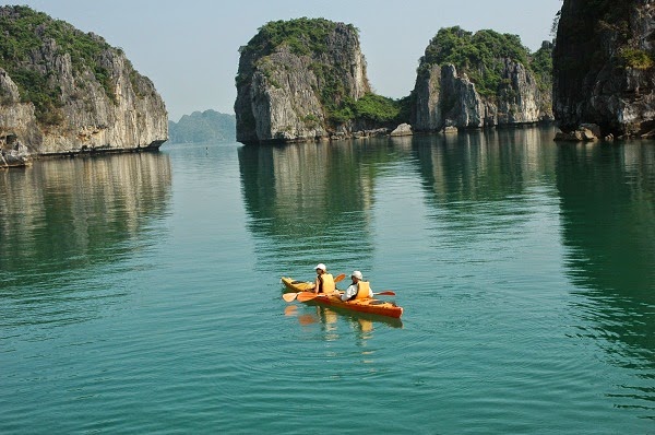
The most ideal time to gaze the islet is at the sunset. By kayaking or from the cruise, tourists will see fantastic scenery of Dau Nguoi Islet in red sunshine of late afternoon.

Dinh Huong Islet

5:10 PM |
Dinh Huong Islet (Incense Burner Islet) is so-called Lu Huong Islet. It's located in the southwest of Dau Go Island (about 6 kilometers from Bai Chay Tourist Wharf, Halong).
Dinh Huong Islet comprises only one huge stone. When the tide is low, tourists can see its four pins underneath. The islet is in the shape of an incense burner in the middle of the sea. In the majestic setting of sea and islands, Dinh Huong Islet seems like a holy symbol dedicated to national heroes who died to protect the country.
Dinh Huong Islet is an outstanding site of Halong bay that draws the attraction of several tourists coming to Halong. Nowadays, it’s easy to find the image of Dinh Huong Islet on the 200.000 VND bill.

Yen Ngua Islet

5:07 PM |
Yen Ngua Islet (Saddle Islet) is situated in the center of World Heritage Area of Halong Bay. YenNgua Islet has the height around 10 meters above the sea level. It's famous for the unique shape of a huge saddle rising from a vast expanse of water.
The islet was formed by two stones: one is higher than the other and one is lower. The two stonesare linked with each other and look like a saddle from a far distance. Underneath the point where two stones are linked, small boats can sail through. So that, some people thought the islet is like a sewing machine than a saddle.
As its majestic setting and unique shape, Yen Ngua is one of interesting sites on Halong bay that usually involved in cruising track of tourists when visiting Halong.

Thien Nga Islet

5:01 PM |
Thien Nga Islet (Swan Islet) is a stone island situated on Bai Tu Long Bay, right next to Cong Tay Island. Thien Nga Islet is about 15 meters high above the sea level.
The islet comprises three stones piling on each others. The largest block forms a swan body and the two left shapes a head and neck of the swan. The perfect combination of blocks creates a great sculpture sharing the shape with a swan. Gazing from a far distance, the islet resembles a beautiful swan swimming on the sea and losing its herd.
Thien Nga Islet is a wonderful sculpture of nature that impresses many tourists on the cruise on Halong bay.

Ba mun Island

4:24 PM |
Ba Mun Island is a schist island belonging to the Minh Chau Commune, Van Ðon District. It stretches out parallel to Quan Lan Island, separated by the Ðoi Gate that runs in a north-east direction.
It has the other name, Cao Lo Island. It is 15 km from the shore, 1,800 ha in area with more than 20 km long and narrow wide. It consists of a narrow stretch of earth and stone that runs east to west. The highest peak is Quít Mountain with a height of 397 m. The fauna and flora here are very plentiful. There are many rare species.
It is the only island in Ha Long Bay that is home to a primitive forest. There are countless species of plants and trees, some with giant trunks. This forest is also home to many rare animals such as chamois, deer and monkeys. It is said that many years ago tigers, panthers and elephants once resided on the island. In order to help preserve the forest, on 24 January 1997, the government recognised it as a national park.

Bo Hon Island

4:18 PM |
Bo Hon Island is situated in the center of the UNESCO-declared World Heritage area on Halong Bay. It takes about an hour and a half by boat from Bai Chay Tourist Wharfto reach the island.
Bo Hon Island is one of the most beautiful and largest islands on Halong Bay. It’s actually an island range of linked islets. High lime-stone mountainson Bo Hon Island are featured with vertical cliffs and ever-green forest. From a far, it looks like a majestic citadel in a Chinese ink-brush painting.
Bo Hon Island is famous for its grottoes including Sung Sot Cave (Surprise Cave), Luon Cave, Trinh Nu Cave (Virgin Cave) and Trong Cave (Drum Cave). Therefore, the island has become a preferred stop of tourists in the trip on Halong bay.
Bo Hon Island seems like a natural park with diverse species of flora and fauna. Various kinds of plants such as benjamin fig trees, cycads, orchids, etc. can be found on the island. It’s also home to several wild animals like monkeys, deer and chamois.
 

Cong Do Island

4:05 PM |
Cong Do Island is on the southeastern Halong Bay, about 25 kilometers from Bai Chay Tourist Wharf. It's included in the core area of Halong Bay, which is recognized as the World Natural Heritage Site
Cong Do Island covers an area of 23.36 square kilometers. The island features with a 172-meter hill which is covered by an ever-green tropical forest. Moreover, the lagoons around Cong Do Island are also home to various species such as shrimp, crab, fish, squid and aquatic plants. Particularly, at the southwestern coast of the island, there is a pristine coral reef with the size of 700 meters long and 300 meters wide. The coral reef involves many rare species of coral (like red coral). This is also the habitation of seahorses and many kinds of fish. The coral reef is preserved in good condition.
Cong Do Island is the paradise of holiday. On the island, tourists can have trekking up to the hill and enjoy a panoramic view at the hilltop to charming scenery on Halong bay. It’s also an ideal place for kayaking to discover the hidden lagoons on the island and its bio-diversity. Scuba-diving service is very potential to develop on Cong Do Island.
In the southeast of Cong Do Island, archaeologists found many trails of the ancient commercial port of Van Don. These evidences prove that Cong Do Island in the past had been a transit point of goods in the system of Van Don Commercial Port.
 

Titop Island

3:59 PM |
Situated about 7-8 km south-east of Bãi Cháy lies the small Ti Top Island. It displays a beach shaped like a crescent moon, and sand that has been washed to a snowy white by the tide. On 22 November 1962, this tiny island had the honour of receiving a visit from astronaut Ghermann Ti Top, a hero of the former Soviet Union, accompanied by Hồ Chí Minh.
To perpetuate the remembrance of their visit, Uncle Hồ named the place Ti Tốp Island. It has now become an attractive beach for tourists and has various of tourist services
Thirty-five years afterwards, on 27 June 1997, Ti Tốp returned to the island having his name. Deeply moved, he wrote in the souvenir book of the Management Board of Ha Long Bay: "My deepest thanks to destiny, which has allowed me to come back to this tiny island.” It has become a beach attracting many visitors.

Ba Ham Lake

3:49 PM |
Ba Ham Lake is located in the southwest of Halong Bay. It's on Dau Be Island Range, Lan Ha Bay. The lake is about 25 kilometers far from Bai Chay Tourist Wharf. Ba Ham Lake comprises three round pits linked with each other by a narrow and dark tunnel.
Ba Ham Lake comprises three round pits linked with each other by a narrow and dark tunnel. The tunnel’s ceiling has the height ranging from 4 – 5 meters. Thus, the only way to access the lake is by local sampan. Sailing through the tunnel, tourists can see various stalactitesin strange shapes hung down from the ceiling. The pits inside is enclosed by vertical lime-stone mountains. On these mountains are the residence of many species such as orchids, benjamin figs, banyans and cycads. There, tourists can also have chance to see endemic animals of Halong bay like golden monkeys, flying squirrels, silver-headed parrots, bats and butterflies.
Ba Ham Lake is an outstanding site on Halong Bay where still remains untouched natural scenery and special ecological environment.

Bai Tu Long Bay

3:44 PM |
Bai Tu Long Bay is a beautiful bay of the Gulf of Tonkin, in the northeastern Vietnam. It belongs to the territory of Quang Ninh Province and about 200 kilometers far from Hanoi, the capital city of Vietnam.
Legend said it that in the early era of Vietnam, the country had to fight against powerful invaders. To help Vietnamese people save their country, a family of dragons was ordered by the god to assist them. Dragons spitted out various jewels and jades to form a long and solid citadel. Therefore, the invaders had to give up their invasion plot and sailed their ships back. After the war, the family of dragons stayed on the Earth as beautiful and peaceful scenery there. The bay, where the mother dragon descended, was named Halong bay (Dragon Descending Bay). And the bay where the dragon’s children descended was called Bai Tu Long Bay. Nowadays, variety of islets on Halong Bay is said to be petrified jewels and jades that the dragons spitting out. The island range of Bach Long Vi is considered as the trail of dragon’s tail on the sea.
Bai Tu Long Bay comprises hundreds of islands in both big and small sizes. They belong to two types: lime-stone islands and schist islands. The islands of Bai Tu Long are the result of tectonic process over 300 million years. Many of them are well-known tourism islands such as Quan Lan Island, Minh Chau Island, Ngoc Vung Island, and The Vang Island. Karst corrosion process and weathering created several amazing caves, especially Quan Cave (Navy Cave).
Bai Tu Long Bay has a rich biodiversity with typical ecosystems: mangrove ecosystem, coral reef ecosystem, ecosystem of tropical forests. It is home to various species of flora and fauna. There are 780 species of flora in Bai Tu Long Bay and 21 species among them are included in the list of Vietnam’s Red Data Book. Scientists also found 931 species of aquatic animals there. In 2001, Bai Tu Long National Park was established with the area of 14 ha in order to preserve biodiversity in this region.
Bai Tu Long Bay has the total population of 30.000 people whose livelihoods depend mainly on farming and fishing. On Bai Tu Long, there remain many archaeological relics of Halong Culture (dating around 3.000 – 2.000 BC) and historical trails of the ancient Van Don commercial port (in 13th century).